Survey, plat & easement digitization
Translate plats and certified survey maps into parcel-limited PUEs, easement geometry, source-linked attributes, and reviewable GIS layers.
Practical GIS · Custom cartography · Spatial tools
Custom Map Services turns plans, parcels, and location data into clear maps and practical GIS tools—made for print, web, fieldwork, and confident decision-making.
Remote project support · Clear deliverables · Built to fit your workflow
From property questions to project decisions.
Spatial clarity.Services / 01—08
Start with a single map or bring an entire workflow. Each project is scoped around your goals, intended use, and clearest way to deliver the result.
Translate plats and certified survey maps into parcel-limited PUEs, easement geometry, source-linked attributes, and reviewable GIS layers.
Connect parcel lists, legal descriptions, recorded maps, and source references into a consistent research system.
Produce staking sheets, permit exhibits, map books, construction-reference packages, and presentation-ready PDFs with controlled cartography.
Segment routes at risk boundaries, compare design and as-built conditions, analyze terrain and drainage, and prepare decision-ready summaries.
Publish interactive review maps, dashboards, hosted layers, controlled editing workflows, and mobile-ready field tools.
Replace repetitive mapping work with dependable ArcGIS tools, batch processes, quality checks, and map-series workflows.
LiDAR, elevation models, contours, drainage screening, georeferenced plans, and before-and-after imagery comparisons.
Coordinate plans, CAD, survey, parcels, LiDAR, stormwater, borings, photographs, and site observations in traceable 2D and 3D review environments.
Selected capabilities
Original project work and clearly labeled clean-room demonstrations show how print, web, mobile, and 3D deliverables can work together.
Print · Web · Mobile
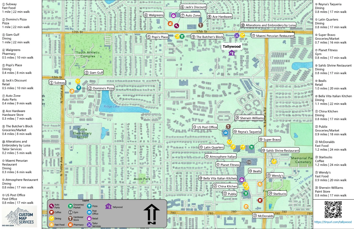
A coordinated mapping package that moves naturally from a printed community guide to an online map and portable navigation files.
Property · Recreation · Regional context
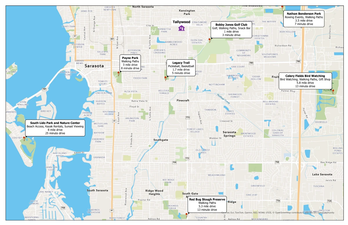
A regional companion map gives residents and visitors an immediate view of parks, trails, beaches, and other useful destinations by driving distance and time.
Archives · Routes · Georeferencing
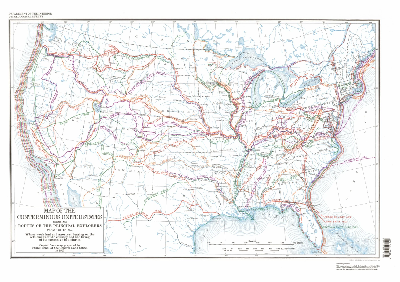
Historic map sheets were georeferenced and paired with digitized explorer routes to turn archival geography into a usable spatial record.
Public data · Fictional project · Land access
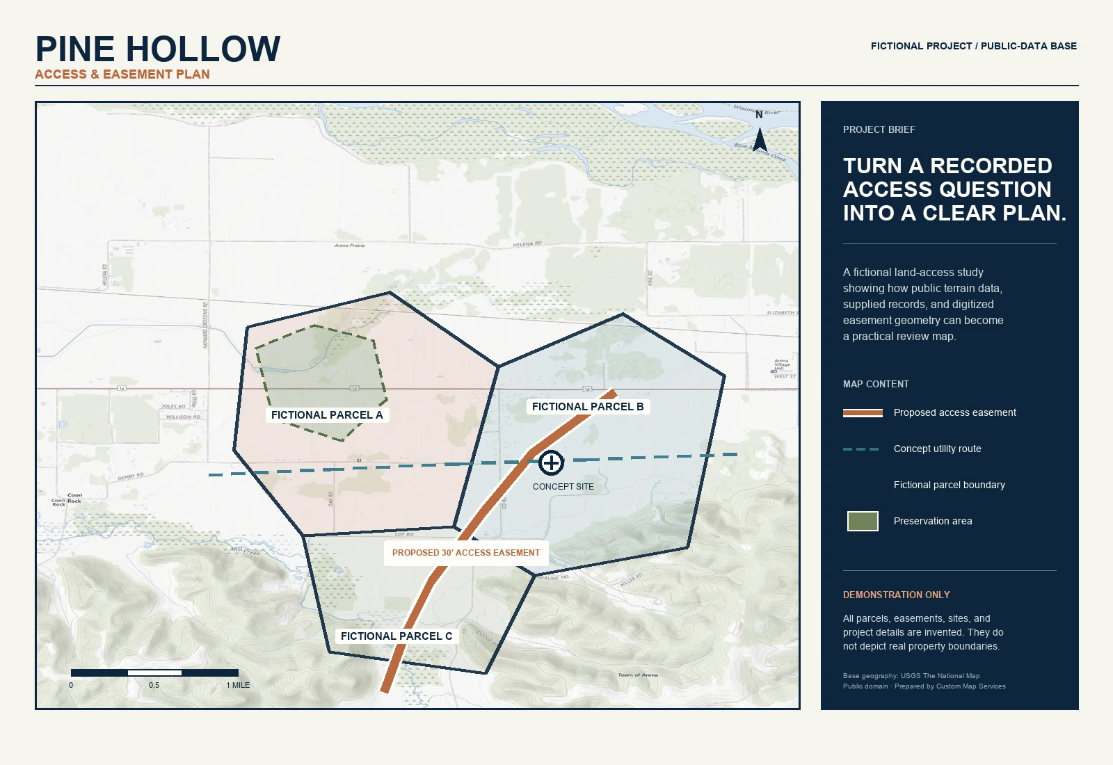
A clean-room demonstration combining a public-domain USGS topographic base with completely fictional parcels, a proposed access easement, a utility route, and a preservation area.
Fictional project details on a public-domain USGS base map.
Clean-room telecom workflow · Automation · Excel handoff
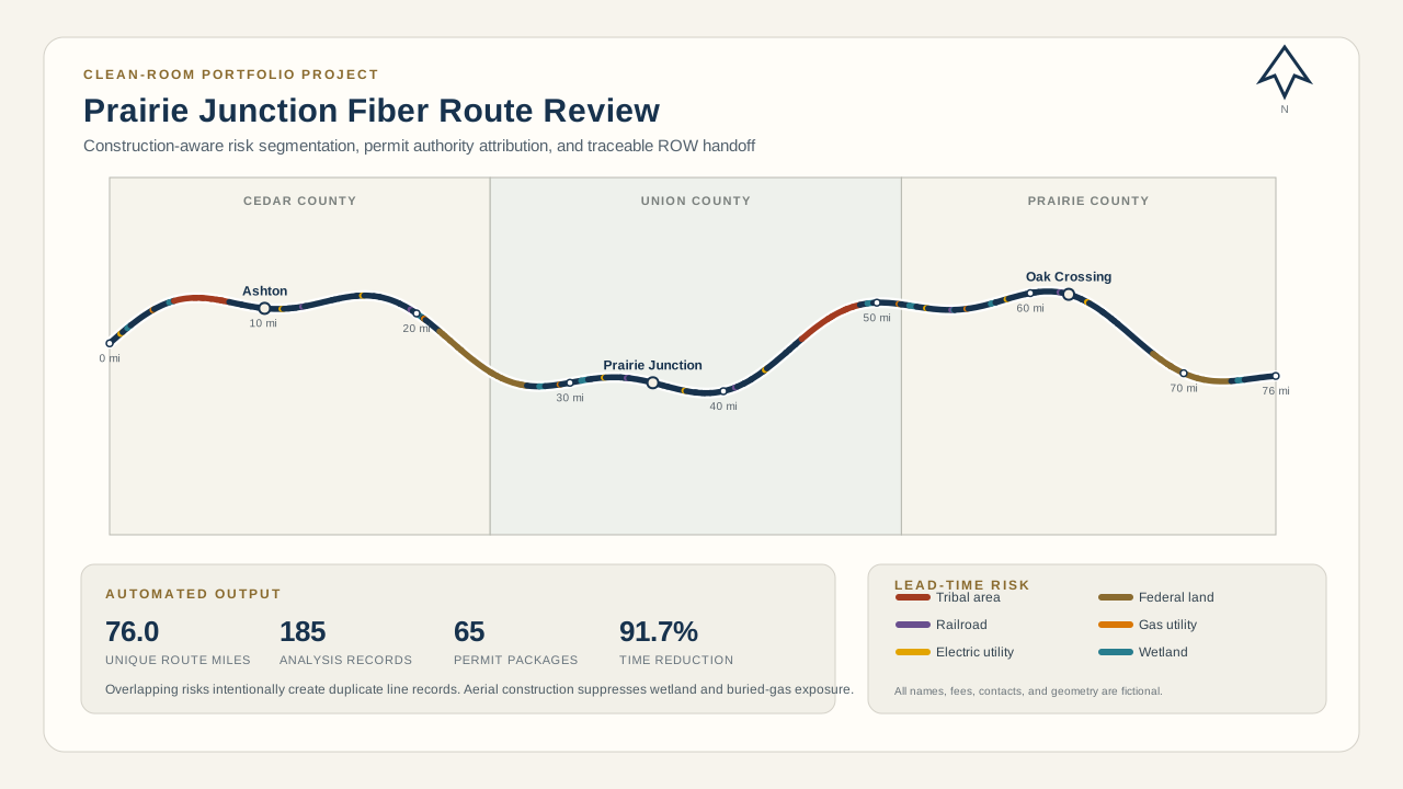
A fictional 76-mile aerial and buried design is split wherever construction method, jurisdiction, or risk exposure changes. Every segment receives county, municipality, DOT, and permit-authority information; overlapping risks remain separate records; aerial plant excludes wetland and buried-gas risk; and shared permit IDs connect the map, permit polygons, and Excel findings package for engineering, right-of-way, and budgeting.
Clean-room demonstration built from synthetic geometry, fictional organizations, and editable planning assumptions. No employer or customer material is used.
Representative telecom workflow · Plats · Easement data
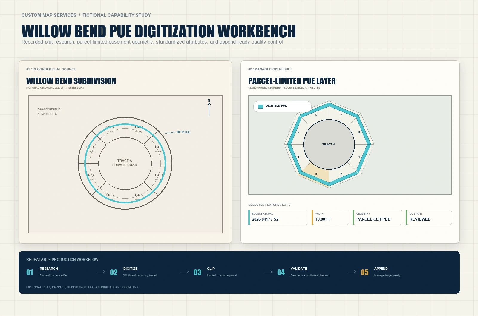
A source-to-result workbench demonstrates plat research, PUE interpretation, parcel-limited digitization, standardized source attributes, geometry validation, and an append-ready handoff to a managed enterprise layer.
Representative of documented plat and public-utility-easement responsibilities. The plat, recording information, parcels, and geometry are fictional.
Representative engineering-forensic workflow · Plans · 2D review
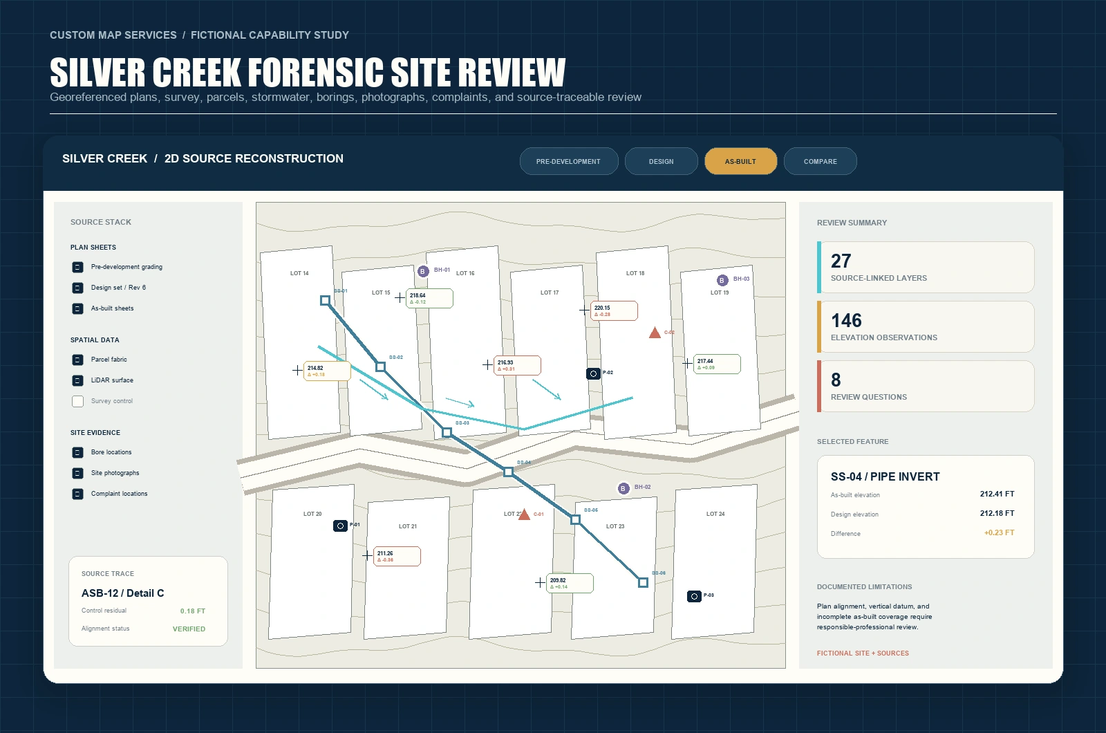
A representative site-review map coordinates georeferenced pre-development, design, and as-built plans with parcels, survey information, stormwater, boring locations, photographs, complaints, elevations, and documented source relationships.
Representative of documented engineering-forensic GIS responsibilities. The site, source documents, observations, and findings are fictional.
Representative engineering-forensic workflow · Elevations · Drainage
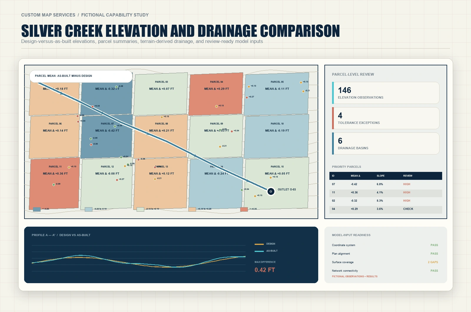
A review exhibit combines source-linked spot elevations, parcel-level variance summaries, terrain-derived drainage paths, an outlet network, elevation profiles, and model-input checks while keeping observations distinct from derived results.
Representative of documented elevation, terrain, drainage, and model-preparation responsibilities. All observations and analytical results are fictional.
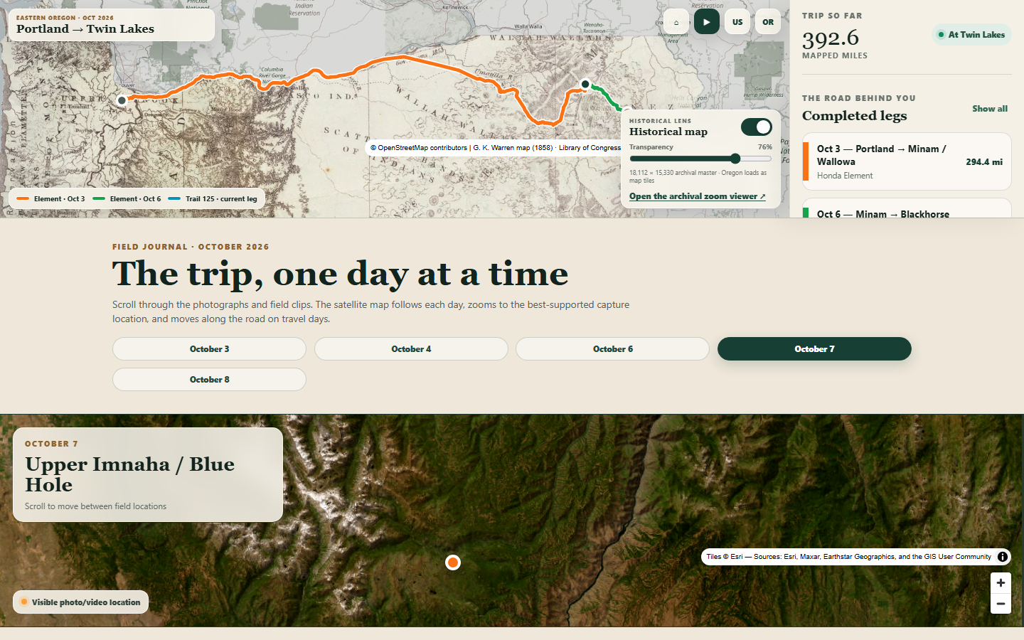
Adventure Visualized · Interactive story map · Field journal
An evolving visual field journal combines the trip route, historical cartography, satellite context, photographs, video, and downloadable navigation files in one interactive experience.
A live project from the October 2026 Eastern Oregon road trip, visualized by Custom Map Services.
A clear working process
Clarify what the map needs to communicate, who will use it, and what a successful deliverable looks like.
Review plans, records, coordinates, spreadsheets, imagery, and existing GIS data for gaps and constraints.
Create the spatial product, document assumptions, check geometry and attributes, and refine the visual hierarchy.
Provide the right print, web, mobile, GIS, or data formats—plus a clear handoff for what comes next.
About Custom Map Services
Custom Map Services combines environmental-science perspective, graduate-level GIS training, practical cartography, and extensive ArcGIS workflow experience.
The focus is simple: understand the source, protect the details that matter, and build a map or spatial tool that makes the next decision easier.
Start a conversation
A useful first message includes the project location, available source files, intended audience, preferred deliverable, and any deadline.
Prepare a project inquiryContact delivery will be connected when the preferred business email is confirmed.